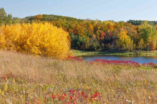
Natural Systems
Abundant and thriving natural systems are essential to our region’s quality of life, though they vary from healthy and connected to fragmented and polluted. Comprehensive planning offers the chance to protect, restore, and enhance natural systems while guiding where and how future growth should occur. Assessing existing systems helps identify where development can integrate with restoration opportunities and where protection should take priority.
- Assessment: Map and evaluate natural systems to understand their current condition and connectivity.
- Protection & Restoration: Preserve high-quality natural areas, limit harmful development, and use redevelopment as opportunities to restore degraded systems.
- Integration & Implementation: Align land use, transportation, and infrastructure decisions with natural systems planning, prioritize opportunities, and adopt strategies for action.


Climate and Natural Systems Toolkit [Coming Soon]
Minimum Requirements
Minimum requirements are the baseline elements every community must include in their comprehensive plan. They ensure consistency and compliance with state law, and alignment with regional policy. These requirements create a foundation that allows local plans to reflect community priorities while supporting regional goals. For more information about minimum requirements, click here.
Using the table
- Filter: by community, policy topic area, or explore new/updated requirements for the 2050 planning cycle.
- Ref No: Each requirement has a unique identifier. Gaps in numbering mean certain regional requirements do not apply to your community.
- Resources: provides tools, guides, and resources to help meet each requirement. Some requirements may appear more than once if multiple resources are available.
Your complete list of minimum requirements can also be downloaded directly from your Community Page.
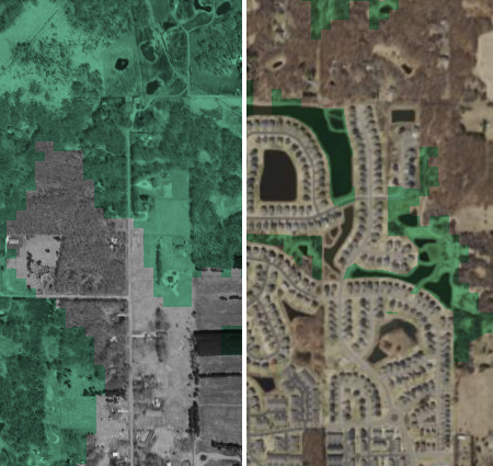
Please consult your related water plans, parks plans, and related comprehensive plan chapters to ensure consistency throughout your Comprehensive Plan. For natural systems requirements #1-4, use the MetroMosaic interactive mapping tool for baseline data. Communities are encouraged to use their own data if it is more up-to-date.
Going Beyond the Minimum Requirements
Meeting the minimum requirements ensures that a comprehensive plan is complete and compliant, but communities that go further can create plans that are truly transformative. By moving beyond the basics, local governments can reflect local priorities, prepare for future challenges, and enhance the unique character of their communities while advancing equity, resilience, and quality of life for all residents. This section offers resources, advice, and best practices to help communities strengthen their plans and set a course toward a more inclusive, sustainable, and vibrant future.
Prepare Natural Resource Information
- Prepare or update a local natural resource inventory that identifies existing natural land cover types through field verification
- When updating a local natural resource inventory, evaluate and update the habitat quality of each land cover type
Develop Plans and Tools
- Develop a decision/prioritization matrix with criteria that identify priority areas and actions for habitat protection and improvement
- Develop an action plan to implement the strategies identified in your Natural Systems Element
Use Data and Guidance Resources
- Use the Minnesota Natural Resource Atlas to easily visualize and analyze spatial data
- Use the MN DNR Natural Resource Checklists in integrating natural resource conservation into local planning
- Use the Sustainable Development Code to build more resilient, environmentally conscious, economically secure, and socially equitable communities
- This APA article: Tech Tools for Conservation Planning and Urban Green Projects recommends tools planners can use to put sustainable infrastructure principles into practice
Explore Funding Opportunities
- Explore funding opportunities via the MN DNR Grants List, the MN Pollution Control Agency Grants List, and the MN Board of Water and Soil Resources Grants List
- Inquire about additional funding opportunities and resources via your local watershed districts or management organizations, soil and water conservation districts, and counties.
Include Goals and Strategies
- Include goals, priorities, and natural resource conservation strategies to protect and enhance natural resources in your comprehensive plan.
- When updating a local natural resource inventory, evaluate and updated the habitat quality of each land cover type.
Collaborate with Partners
- Collaborate with watersheds, adjacent communities, and other partners to identify, plan for, and protect natural resource areas that cross boundaries.
Explore Tools and Best Practices
- Explore the GreenStep Cities 20 Best Practices
- The Minnesota Better Buildings and Beyond (B3) Site Guidelines can be used to help create sites that reduce water and energy consumption; reduce and improve stormwater runoff; minimize pollutant contributions related to transportation; and support, protect, and restore native species habitat and landscapes.
- Browse these EPA Smart Growth and Water planning and design approaches to improve access to quality water resources and mitigate the impacts of development on local watersheds.
- Use the Met Council Growing Shade Tool to inform tree planting and canopy preservation
- The Natural Resource Partnership Coalition provides tools and resources to connect and protect natural systems
- The MN DNR Maintaining and Restoring Natural Shorelines webpage offers methods of shoreline stewardship around homes, neighborhoods, and other properties
- The MN DNR Shoreland Management Program and Bluff and Slope Protections webpages provide strategies, standards, and resources
- Use NatureServe Explorer to learn about rare and endangered species and ecosystems
- Explore resources for planning and designing buffers in rural and urban landscapes on the USDA Agroforestry Conservation Buffers website